2.3 Airways and Radio Navigation Aids
Lesson Progress
Not completed
Aircraft use a network of radio navigation aids (NAVAIDs) to navigate. These are called VORs (the most common), DMEs, VORTACs, TACANs, and NDBs. You can find their symbols on the VNC legend.
Aircraft have receivers that can detect the signals from NAVAIDs and determine the direction, and in some case the distance, to or from a NAVAID. Those NAVAIDs are located close to where aircraft may want to go which usually means airports. Therefore aircraft fly from NAVAIDs to NAVAIDs in defined corridors called airways. The VNC chart shows low-level airways which exists below 12,500’ ASL.
Airways
Section titled “Airways”Here is a cross-section of a low-level airway between two VORs.
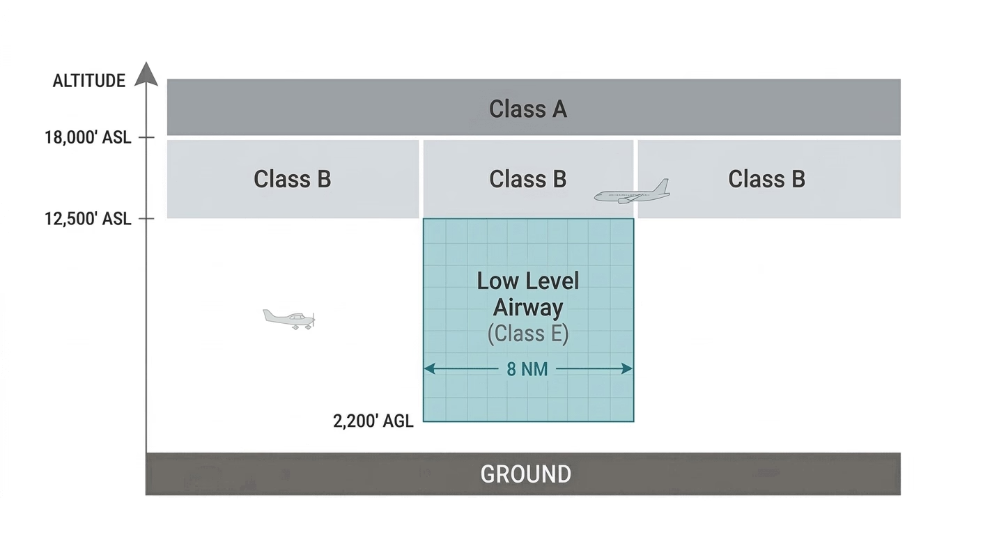
- Airways extend from 2,200’ AGL to 18,000’ ASL.
- Airspace inside the airway is Class B above 12,500’ ASL and Class E below.
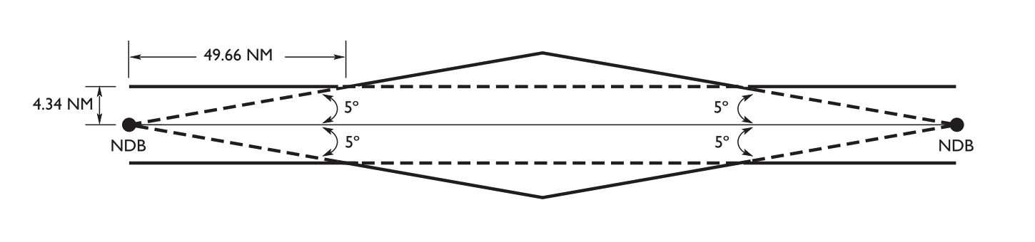
- Note that a low-level airway between a VOR and a NDB would be 8.68 NM wide.
Airway Horizontal Dimensions
Section titled “Airway Horizontal Dimensions”Aircraft radio navigation instruments provide pilots with a bearing to the beacons, and anything within a specified range of that bearing is considered inside the airway. The airway dimensions include the area enclosed by the dashed lines from the beacon until they intersect the solid boundary lines.
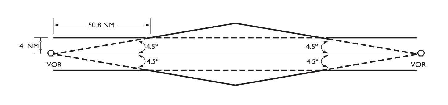
- VHF/UHF Airways (VOR to VOR): Minimum width of 4 NM on each side of the centreline (8 NM total). The boundary expands outward at a 9° angle (4.5° on each side).
- LF/MF Airways (NDB to NDB): Minimum width of 4.34 NM on each side of the centreline (8.68 NM total). The boundary expands outward at a 10° angle (5° on each side).
- Mixed airway (VOR to NDB): Uses the same 8.68 NM total width and 5° expansion geometry as the LF/MF airway.